A Guide to Alameda's Different Neighborhoods
A simple reference for the main residential and community areas people refer to when talking about the city.
Gold Coast
One of Alameda’s most established neighborhoods, Gold Coast is known for its tree-lined streets and well-preserved Victorian, Craftsman, and Colonial Revival homes. It gets name from the concentration of wealth that developed there in the late 1800s and early 1900s.
It's a residential pocket that's quiet and established, yet near Alameda’s main commercial and waterfront corridors. It sits within easy walking distance of Park Street’s shops and restaurants, Alameda High School, and the shoreline paths along Shore Line Drive. It’s also a short bike ride to South Shore Beach and the Posey and Webster Street tubes for Oakland access.
- Located Near: Park Street corridor; Alameda High School; Shore Line Drive; South Shore Beach
- Known For: Grand historic homes; tree-lined streets; central, walkable location
- Who Lives Here: Longtime homeowners, professionals, and families drawn to classic architecture and a central address
Fernside
A long-established residential neighborhood on the east side of the island, Fernside known for its laid-back mix of Craftsman, bungalow, and mid-century homes. The area developed primarily in the early 20th century as Alameda expanded eastward.
Fernside sits just east of Park Street, within walking or biking distance of Lincoln Middle School, Otis Elementary, Encinal High School, and the shops and cafés along Park Street. It’s also close to Encinal Boat Ramp, Littlejohn Park, and the shoreline along the Estuary.
- Located Near: East Park Street; Otis Elementary; Lincoln Middle School; Encinal shoreline
- Known For: Quiet residential blocks; family-oriented feel; Craftsman and bungalow housing
- Who Lives Here: Families, school-focused households, and residents looking for a calm, neighborhood-first setting
South Shore / Shoreline
This bayside neighborhood defined by its direct access to the shoreline and a more open, beach-adjacent feel than much of the rest of the island. The area developed largely in the mid-20th century, with a mix of low-rise apartment buildings, condos, and single-family homes oriented toward the water rather than historic street grids.
South Shore runs along Shore Line Drive and centers on South Shore Beach and the South Shore Center shopping plaza, putting groceries, everyday retail, and cafés right by the sand. It’s one of the most walkable-to-the-beach parts of Alameda, with paved shoreline paths, wide views across the Bay, and easy bike connections back toward Park Street and the Posey and Webster Street tubes for Oakland access.
- Located Near: South Shore Beach; Shore Line Drive; South Shore Center
- Known For: Beach access; bay views; apartments and condos oriented toward the water
- Who Lives Here: Renters, downsizers, and beach-oriented residents who value walkability to sand and retail
West End
At the western edge of the island is one of Alameda’s most historically layered neighborhoods, with a mix of Victorian-era homes, early 20th-century cottages, and smaller apartment buildings. It developed early alongside the city’s industrial and maritime growth, giving it a more working-class, locally rooted character than the Gold Coast or East End.
The neighborhood centers on Webster Street, where grocery stores, longtime local shops, and everyday services create a practical, lived-in commercial corridor. West End is also closest to the Posey and Webster Street tubes and the Alameda–Oakland ferry terminals, making it one of the most convenient parts of the island for commuting to downtown Oakland or San Francisco.
- Located Near: Webster Street; Posey and Webster Street tubes; Alameda–Oakland ferry
- Known For: Historic working-class roots; strong local retail corridor; commuter convenience
- Who Lives Here: Commuters, longtime locals, and residents who value transit access and everyday practicality
East End
East End occupies the eastern portion of the main island and is known for its quieter, more residential feel and cohesive blocks of early- to mid-20th-century homes. The area overlaps with and sits adjacent to Fernside, sharing a similar mix of Craftsman, bungalow, and ranch-style houses, but generally feels a bit more tucked away from Alameda’s main commercial corridors.
It's anchored by neighborhood schools, local parks, and quick access to the shoreline along the Estuary, with easy bike and car connections to Park Street and South Shore.
- Located Near: Fernside; Encinal Estuary shoreline; neighborhood schools and parks
- Known For: Calm, tucked-away residential feel; consistent early- to mid-century housing
- Who Lives Here: Homeowners and families looking for quieter streets away from commercial corridors
Bronze Coast
This small, central neighborhood isoften described as a bridge between Gold Coast and the rest of the island. It’s characterized by well-kept early-20th-century homes—primarily Craftsman, bungalow, and Colonial Revival—on compact, walkable blocks.
The area sits near Alameda High School, Lincoln Park, and the Park Street corridor, putting shops, restaurants, and transit within easy reach. It offers a nice central location and strong neighborhood feel, without the larger scale or prestige sometimes associated with the Gold Coast.
- Located Near: Alameda High School; Lincoln Park; Park Street corridor
- Known For: Central location; smaller-scale historic homes; understated character
- Who Lives Here: Residents who want proximity to Park Street without the scale or formality of Gold Coast
Harbor Bay / Bay Farm Island
Just south of the main island, this area feels distinctly separate from Alameda’s older neighborhoods, both in layout and character. Developed primarily from the 1970s onward, it’s a planned community of townhomes, condos, and single-family houses with wide streets, lagoons, and a more suburban, master-planned feel.
It's anchored by Harbor Bay Landing shopping center, Harbor Bay Club, and extensive waterfront paths along the Bay, with easy access to the Bay Farm Island Bridge for commuting to Oakland. Harbor Bay appeals to residents looking for newer housing, quieter streets, and direct shoreline access, even if it feels less walkable or historic than Alameda’s main island neighborhoods.
- Located Near: Harbor Bay Landing; Harbor Bay Club; Bay Farm Island Bridge
- Known For: Planned community layout; newer housing; lagoons and waterfront paths
- Who Lives Here: Families, professionals, and buyers seeking newer homes and a suburban-style layout
Marina Village
This compact waterfront neighborhood stands at the northern edge of the main island. Built largely in the 1960s and 1970s around a protected marina, it's characterized by low-rise apartments, condos, and townhomes.
It sits near the Oakland Estuary, with marina paths, boat slips, and bay views defining daily life. Marina Village feels quieter and more insular than Park Street–adjacent areas, but offers quick access to Webster Street shopping, ferry connections, and nearby bridges into Oakland.
- Located Near: Oakland Estuary; Webster Street; ferry routes and bridges
- Known For: Marina-oriented living; condos and townhomes; insular, waterfront setting
- Who Lives Here: Condo owners, boaters, and residents who prioritize water access over retail walkability
Central Alameda
This area refers less to a single, distinct neighborhood and more to the broad residential core of the island between the West End and the East End. It’s characterized by consistent blocks of early- to mid-20th-century homes—primarily Craftsman, bungalow, and small multi-family buildings—laid out on Alameda’s classic, flat street grid.
Central Alameda is closely tied to the Park Street corridor, putting shops, restaurants, schools, and transit within easy walking or biking distance. The area tends to feel practical, lived-in, and neighborhood-focused, offering a balance between convenience and everyday residential calm without a strong “brand-name” identity like Gold Coast or Harbor Bay.
- Located Near: Park Street; schools; island-wide bike and transit routes
- Known For: Everyday residential core; walkability; mix of housing types
- Who Lives Here: A broad mix of renters and homeowners who want convenience without a distinct neighborhood label
Alameda Point
Long defined by hangars, runways, and industrial buildings, the area sits at the western tip of the island on the site of the former Naval Air Station. It's now in active transition, with a mix of adaptive-reuse spaces, new housing, creative offices, breweries, and waterfront parks.
Alameda Point is anchored by destinations like the USS Hornet Museum, Spirits Alley, and expansive shoreline paths. It’s less about established residential blocks and more about scale, openness, and experimentation.
- Located Near: USS Hornet Museum; Spirits Alley; west-end shoreline
- Known For: Adaptive reuse; large-scale redevelopment; creative and industrial spaces
- Who Lives Here: Early adopters, creatives, and residents drawn to newer housing and nontraditional environments
Is there a "Downtown" Alameda?
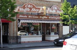
When people say “downtown Alameda,” they usually mean Park Street and the immediately surrounding block. It's a walkable, small-city main street that functions as Alameda’s commercial center.
Park Street cuts north–south through Central Alameda and sits right at the edge of Gold Coast, Bronze Coast, and parts of Fernside. It's the island’s main retail and dining spine, anchored by grocery stores, restaurants, cafés, the historic Alameda Theatre & Cineplex, and everyday services. It’s also where several bus lines converge and where foot traffic is most concentrated.
How does Admiral's Cove fit into this?
Admiral’s Cove sits west of Webster Street and north of the main West End residential grid, made up mostly of waterfront condos and townhomes clustered around marinas and internal drives. Because of its layout and housing type, it feels more insular and resort-like than the surrounding West End blocks, even though it shares the same proximity to Webster Street shopping, ferry access, and Oakland commute routes.
What further set the community apart is its townhome-oriented layout, with apartments featuring private backyards, along with shared green space, community amenities, and waterfront walkways woven through the community. It's geographically West End—but with a distinct waterfront identity of its own!